Sant Fruitós – Sant Benet scenic path
Difficulty: 1
Distance: 3,25 km
Elevation gain: 108
Elevation loss: 57
Starting point: El Bosquet de Sant Fruitós de Bages
Finishing point: Monestir de Sant Benet de Bages
Services: Farmàcies i comerços als nuclis de població de Sant Fruitós de Bages i Navarcles, restaurants, allotjament. Oficina de turisme al Món Sant Benet.
Wikiloc: https://ca.wikiloc.com/rutes-senderisme/cami-paisatgistic-de-sant-benet-2141328
Points of interest: Monestir de Sant Benet de Bages, mirador al monestir de Sant Benet, mirador del Llobregat, barraques de pedra secaMonasterio de Sant Benet de Bages, mirador al monasterio de Sant Benet, mirador del Llobregat, barracas de piedra seca
Parking / How to get there: El Bosquet està situat entre l'Avinguda de Sant Jaume I i la Crta. Torrent de FontetaEl Bosquet està situado entre la Avenida de Sant Jaume I y la Crta. Torrent de Fonteta
More information: Ruta ideal per a fer en famíliaRuta ideal para familias con niños
Fullet Camí Paisatgístic de Sant Benet de Bages
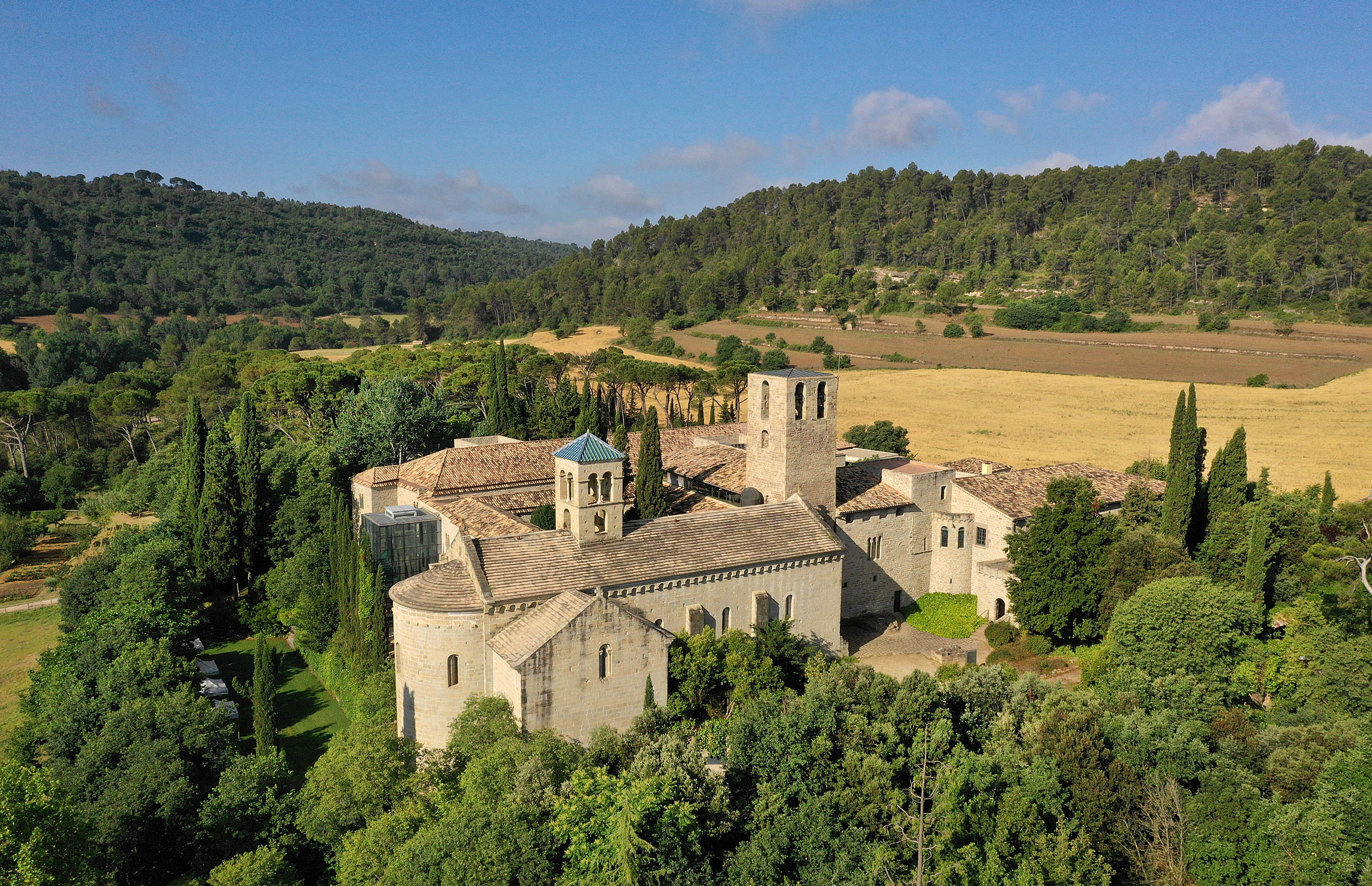
This path of great scenic beauty is the historical route that, with just over 3 kilometers, connects the town of Sant Fruitós with the Monastery of Sant Benet. It is an ideal route for families.
El Bosquet is the starting point of this itinerary, from where walking or mountain biking, you can see constructions of dry stone walls and vineyards very well preserved between fields and with the summit of Montcau and the Montserrat mountain range as a backdrop.
A very remarkable point of interest and great scenic beauty is the Mirador de Sant Benet. From this place, almost 300 meters above sea level, you have a privileged view of the whole monastery and its surroundings.
Before reaching the monastery of Sant Benet, we can see the route of the river Llobregat at the eastern end of the Pla de Bages. At this point we will see the “Pont Vell”, built shortly after the confluence of the rivers Llobregat and Calders. Its construction began on July 25, 1796 and was not completed until 1804. It has a total length of 121.75 meters, with seven arches of unequal proportions. Due to its strategic importance, it was blown up during the Civil War. It was finally rebuilt in 1946.
The route is linear and can be done in reverse. In hot weather, we recommend wearing water, sunscreen and hats.